The lake is controlled by a dam on Elm Creek. This allows the Rice Lake Area Association and City of Maple Grove to control the lake level when necessary. The lake basin receives water from various sources (creeks, residential and commercial drainage systems, etc.) which cover over 100 square miles in the northwest Hennepin County area. High levels of phosphorous enter the lake from these many sources and contribute to accelerated and heavy weed growth. In some situations, this heavy weed growth impedes or halts navigation by water craft.
Rice Lake Association members have tried harvesting and spraying the weeds, but these solutions are only temporary and not very effective in covering such a broad area. A more efficient way of attacking the problem is by doing a drawdown in the winter months and exposing the lake bottom to the elements. A good hard freeze without snow cover, similar to what we've experienced most of this winter so far, could be very beneficial in stunting the growth of weeds for the next year and possible future years.
The Minnesota DNR has directed the RLAA to install and run an aeration system during the winter months to help sustain the fish life with extra oxygen (since the drawdown should be lowering the oxygen level with the reduced amount of water). The area is posted with signs warning of Thin Ice in the vicinity.
Thanks to the Putland boys for finding this as well has removing this old gas line sign by the County Road 30 bridge (click here)
October 6 - Flow blockage Elm Creek into Rice Lake
Debris blocking flow from the west side of the lake under I-94 bridge (click here)
October 10 - Flow reduction under County Road 30 Bridge
Gas line reducing blocking flow under the bridge (click here)
October 11 - Malone Bay High Spot (distant photo)
This is the area SE of Glacier Lane which has been marked by a Rock buoy the last 2 years. (click here)
October 12 - Tristan Bay Footbridge
Located in the NE portion of the lake where the creek exits. Views looking SE and NW.
October 23 - Malone Shoal
A close-up view of the high spot marked by a Rock buoy in the SE corner of the lake SE of Glacier Lane (click here)
October 24 - Stonehenge Island
Located in the far NW corner of the lake this is the high spot which has been marked with a red/orange buoy over the years. Buoy anchors lost over the years are recovered during drawdowns like this one. (click here)
November 4 - Margaritaville visits Rice Lake
Someone took the opportunity on a nice afternoon to beach their rowboat on the old Farmers Road ridge and enjoy the pleasant day in a chair. (Does anyone know who this was?) (click here)
November 7 - Elm Creek flow through Tristan Bay
Here are a couple of views of how the creek flows out of the lake through the Tristan Bay neighborhood in the NE corner of the lake along the trail from the adjacent townhomes on 92nd. Views looking NE and SE.
November 13 - Beaver Dam obstructing backwaters to Fish Lake
A well-constructed beaver dam under the I-94 bridge towards Fish Lake is blocking flow out to the lake. The City has committed to removing this dam over the winter to allow proper flow. (Click here for photos)
January 20 2026 - Still some open water on Elm Creek
There is still some open water in the creek on the outlet side of the lake (Tristan Bay upwards towards dam), even with this latest cold snap. Water levels were slightly elevated by recent precipitation. (Click here for photos)
January 28 2026 - Beaver Dam broken down in backwater area
The beaver dam which blocked water flow out of the backwater area between Fish and Rice Lake was recently demolished. (Click here for photos)
February 8, 2026 - City crews trim trees on Elm Creek outlet side
The City Parks Department spent several days trimming trees which were considered hazards to navigation along with removing ash trees (which may lead to worsening the Emerald Ash Borer disease). (Click here for photos)
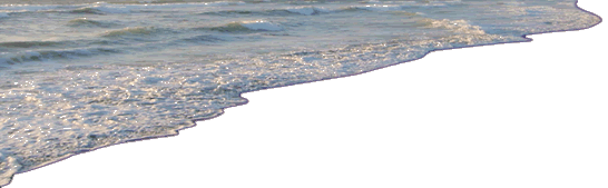
March 10, 2026 - Water level rising with recent precipitation
Due to recent precipitation within the Elm Creek Watershed and the constraints of the Rice Lake Dam (due to 2021-2022 vandalism), the water level has been rising. Rest assured the City will not be closing the dam until all of the ice is out on the lake to avoid damage to shorelines and docks/lifts/etc. Click here for photo of water level just south of the dam.
April 1, 2026 - Dam is closed; water level beginning to rise
The city closed the dam now that all the ice is out on the lake. The water level has already begun to rise and with forecasted precipitation later this week, it may fill up quickly. Click here for photos of water level at the dam and below the dam.